Lower Columbia Estuary Partnership: Experience Vancouver Lake Map
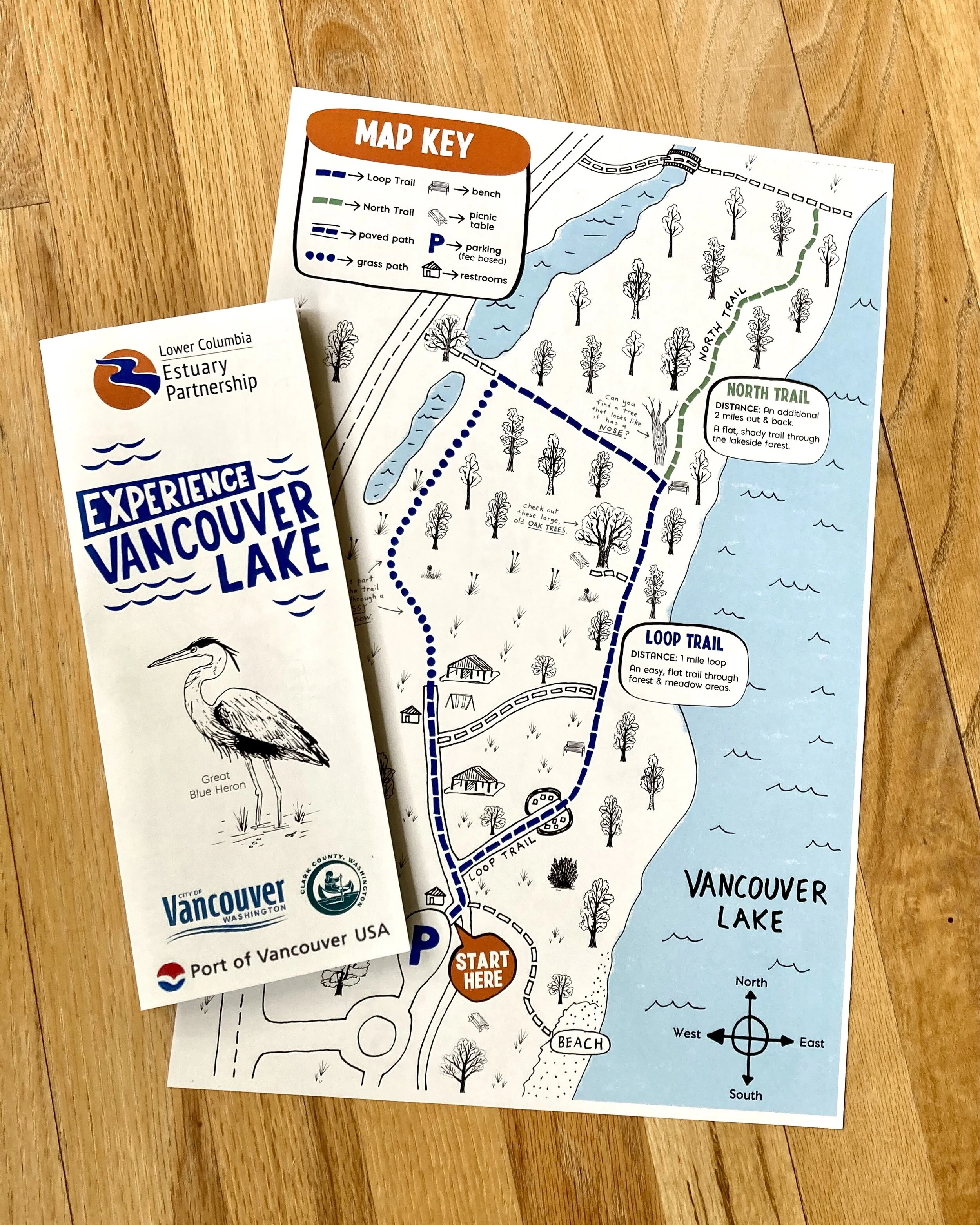
The “Experience Vancouver Lake” Map was commissioned by the Lower Columbia Estuary Partnership, a Vancouver, Washington, based non-profit organization dedicated to protecting the Columbia River basin and educating the community, as part of the educational programs there, in partnership with Clark County, the City of Vancouver, and the Port of Vancouver.
The map is part of the "Experience Vancouver Lake" campaign, which encourages Vancouver area students, families, and community members through programs that build awareness and appreciation for Vancouver Lake.
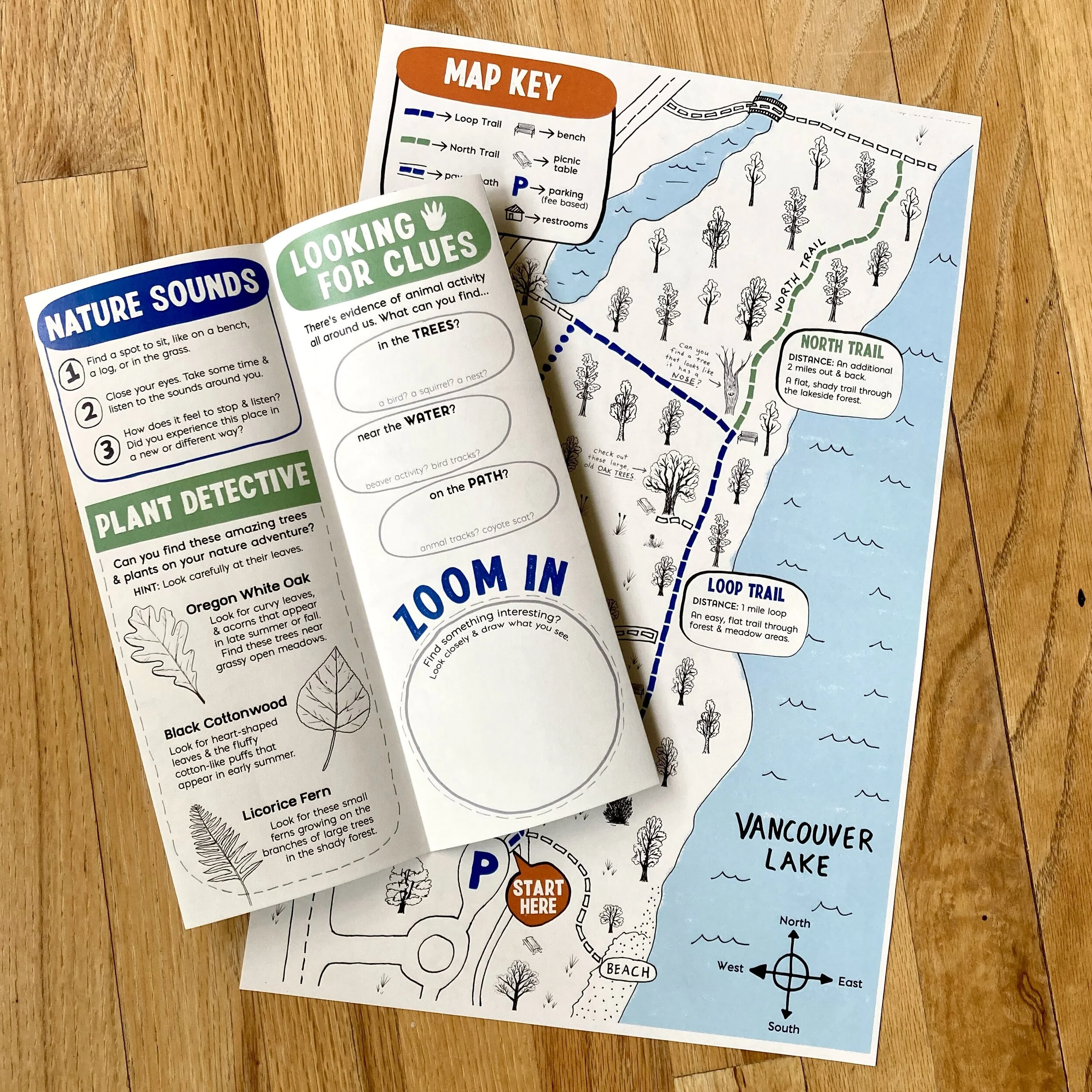
We worked with the educational team at the Lower Columbia Estuary Partnership over a series of content creation and design review meetings to come up with a trail map and activities with the goal of providing opportunities for students and families to learn more about Vancouver Lake, and make a more personal connection to the place. The map includes some of the staff educators’ favorite features that they like to use during educational programming.
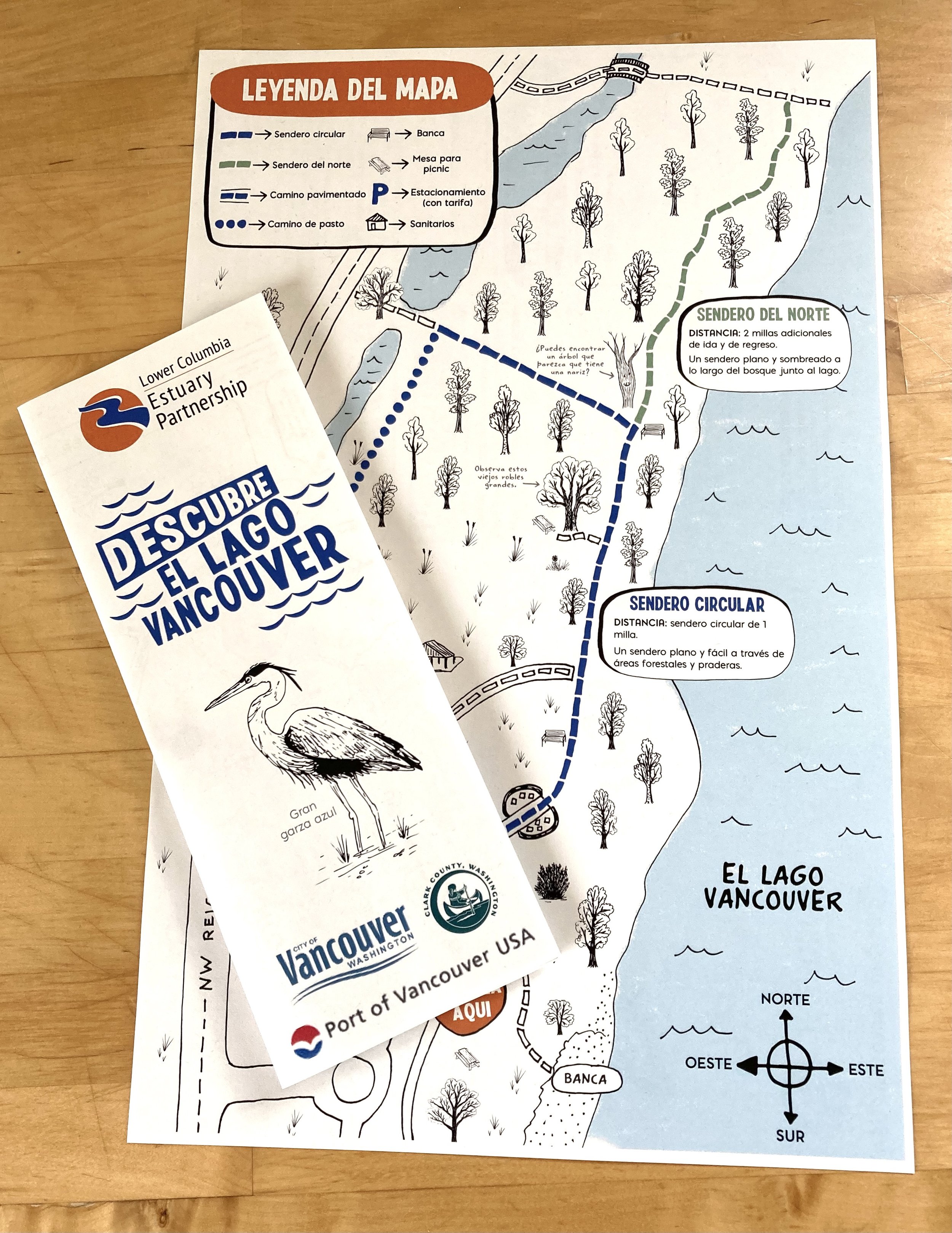
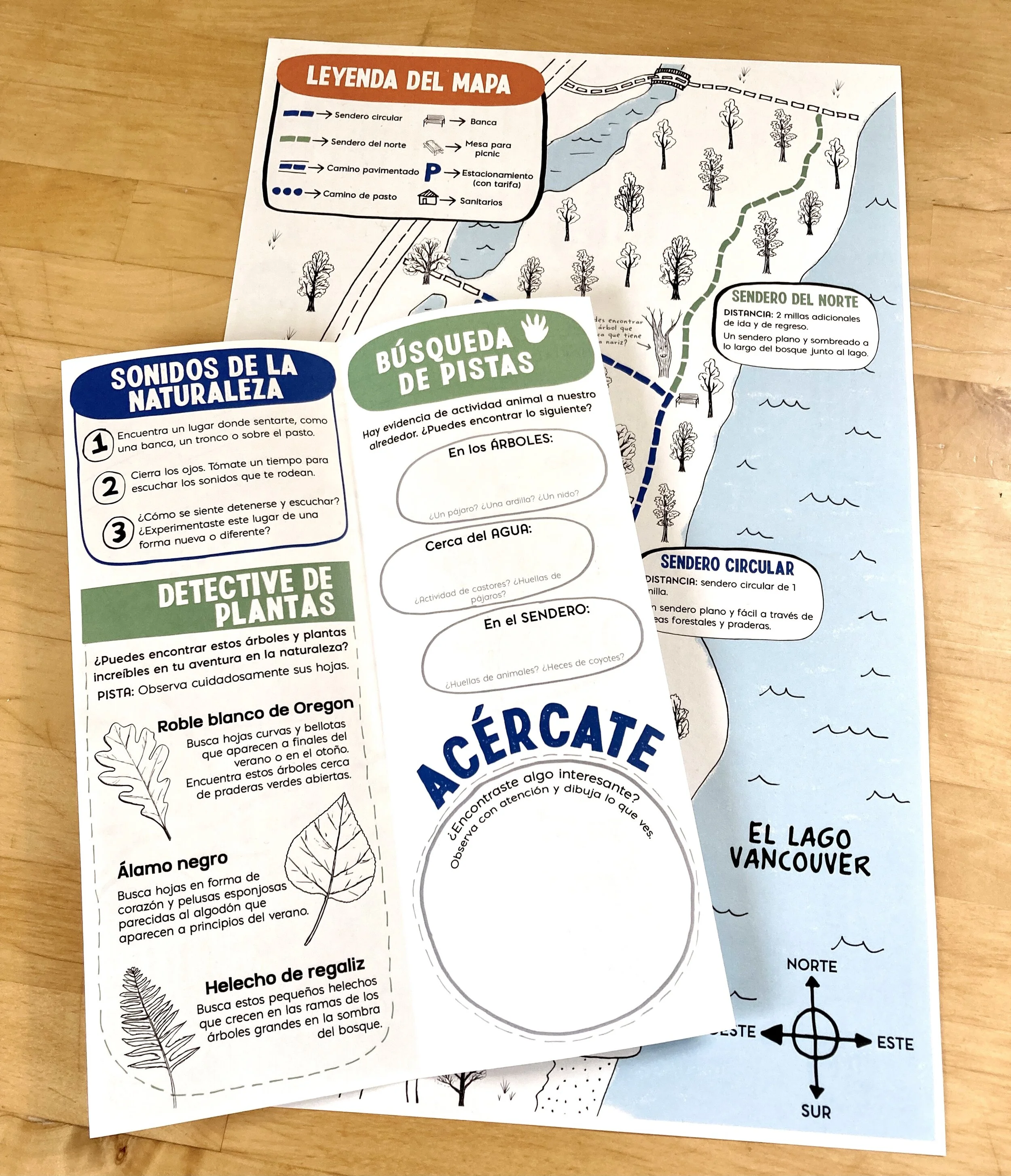
This map was also translated into Spanish. For the Spanish translation, Lower Estuary Partnership worked with a Spanish translator on the wording, which we then incorporated into the design of the map. It serves an important need of broadening environmental education access.